Overview
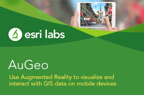
AuGeo, latin for 'augmented', is an Esri Labs initiative to explore the possibilities of using ArcGIS data in an augmented reality environment. Available to ArcGIS users for free in the iTunes and GooglePlay stores, the AuGeo mobile app allows you to easily bring data from your existing ArcGIS point feature layers into an augmented reality mobile app. Preparing your existing data for use within AuGeo is very straight-forward as described in this tutorial.
We at Esri Labs
see many potential uses for Augmented Reality in GIS. While we love maps,
locating assets around you can be easier through the lenses of a camera on your
phone or tablet. Through an augmented reality view, we can more intuitively
represent hidden assets (underground, covered by vegetation or snow), reducing
the time needed for people to find what they were looking for. Will
augmented reality help perform asset inspections more quickly? Will it
guide rescue teams towards a fire hydrant that otherwise would be missed?
Will it provide the ultimate mobile user experience for the most technology
averse real estate agent? Will it be the foundation for the next tourist guide
of your city?
.
As a Research Project from Esri Labs, our intent with AuGeo is to make interesting technology available to you, so we can explore the possibilities together. To start with AuGeo, all you need is an ArcGIS Online subscription, some data and a mobile device. We would love to hear your feedback through our Github Repository and evolve what already looks like a gold (Au) mine of possibilities.
.
Are you a
developer? AuGeo is built using ArcGIS AppStudio. The source code of this application is available in AppStudio.
.
Esri Labs projects are released to public as non-commercial offerings but are NOT official Esri products. These projects do not have to go through the standard rigorous software development lifecycle and testing as other official Esri products. Esri Labs projects may not be holistically tested or documented, and are NOT supported by Esri Technical Support. For a detailed liability waiver, read here.
Business needs
Contact provider for more information
Industries
- National Government
- Public Safety
Works with
Contact provider for more information
Platform
Contact provider for more information
System Requirements
Version
1.2.6 released March 2021
Listed Date
April 20th, 2017
Contact Information
Esri Labs